


Planning portal location plan feature update 2023

Contents |
[edit] Planning Portal launch new location plan feature
The Planning Portal location plan feature means a process change for applicants when creating and submitting applications. From a practical point of view, the planning portal are keen that members and affiliates are aware as it will be a process change and the new service will be an integrated feature when making applications.
[edit] What is the new location plan service?
The new location plan service will allow applicants to easily draw the application site ‘red line’ boundary on a map, after finding the site address using the postcode search (or the location by entering a grid reference). Alternatively, the applicant can upload a GeoJSON file. This new service can be used as an alternative to purchasing a location plan elsewhere, offering an easy, integrated solution.
Once the application is submitted, the Local Authority will receive this boundary information as location data (GeoJSON format). The shift from ‘documents’ to ‘data’ is a key tenet of UK government’s objective to digitise and standardise planning processes nationwide.
However, until the legislation is changed and Local Authority systems can utilise the data, Planning Portal will also automatically create a location plan PDF, showing the boundary and meeting all current policy requirements that will also be received by the Local Authority as a separate supporting document.
[edit] Benefits of a consistent process
By introducing this feature to the Planning Portal, everyone benefits from a consistent process.
For users, they can draw the site boundary as part of their application journey on the Planning Portal using our simple tool – saving time and therefore money, on each application, or upload their own file. As an additional benefit, planning professionals can retrieve a copy of their location plan as a PDF or data file, for uploading directly into their own systems.
Local Planning Authorities receive information in a standard way for each application, which is checked against legislative criteria – reducing the likelihood of an invalid location plan. The method also reduces the manual effort involved in re-plotting the site location, and the user’s process is the same for every application, regardless of which Local Authority receives it. We know from our experience, and the introduction of our payment service specifically, that this standardised approach brings greater efficiencies for all.
[edit] Service charge for applications
The current service charge to make an application will be increased with inflation as usual and a small additional amount added to cover the cost of the new feature. The amount for the new feature is comparable to existing costs for purchasing this data elsewhere and will allow us to cover the costs of providing the service, including Ordnance Survey licensing and royalties for use of their maps. A small amount of profit from the service is used for ongoing improvements.
A key benefit of the service is that we will use OS as the base map who has a relationship with Local Planning Authorities to share data through the Public Sector Geospatial Agreement (PSGA). Using OS means an uplift in the costs but should mean a smarter and more efficient submission process for all. It also means we can pass the digital location plan file (in GeoJSON format) to LPAs to ingest in their planning systems when currently they are manually plotting this from a PDF plan. This will save them resources in time and staff and should help reduce invalidations due to location plan issues that affected c.22% of submissions.
[edit] DLUHC’s planning data platform and national standards for LPAs
You will be aware of DLUHC’s planning data platform (planning.data.gov.uk) where they are looking to set national standards for LPAs to publish their local plans. As part of this we can then look to build up on our current technical foundations and the new location plan feature to facilitate greater integration with these national and local designations to better inform the planning submission process and the required documentation.
More details can be found at https://www.planningportal.co.uk/services/professional-portal/location-plan
This article appears in the AT Journal issue 146 summer 2023 as "Planning Portal (England and Wales) update" and was written by Scott Alford, Head of Business Development, Planning Portal.
--CIAT
[edit] Related articles on Designing Buildings
- BIM.
- Common data environment.
- Digital Construction Week 2021.
- Geographic information system GIS
- Global positioning systems and global navigation satellite systems.
- Core strategy for local plans.
- GeoJSON.
- Geospatial.
- ISO/TC 211 Geographic information/Geomatics.
- Land surveying.
- Location and civil engineers.
- Local Implementation Plans.
- Local place plans.
- Local planning authority.
- Local plans expert group.
- Manual to the Building Regulations.
- National planning policy framework.
- National Planning Practice Guidance.
- Planning authority.
- Planning permission.
- Planning portal.
- Real time kinematic RTK.
- Test of soundness for local plans.
- Underground asset register for Britain.
Featured articles and news
RTPI leader to become new CIOB Chief Executive Officer

Dr Victoria Hills MRTPI, FICE to take over after Caroline Gumble’s departure.
Social and affordable housing, a long term plan for delivery

The “Delivering a Decade of Renewal for Social and Affordable Housing” strategy sets out future path.
A change to adoptive architecture

Effects of global weather warming on architectural detailing, material choice and human interaction.

The proposed publicly owned and backed subsidiary of Homes England, to facilitate new homes.

How big is the problem and what can we do to mitigate the effects?
Overheating guidance and tools for building designers

A number of cool guides to help with the heat.
The UK's Modern Industrial Strategy: A 10 year plan

Previous consultation criticism, current key elements and general support with some persisting reservations.
Building Safety Regulator reforms

New roles, new staff and a new fast track service pave the way for a single construction regulator.
Architectural Technologist CPDs and Communications

CIAT CPD… and how you can do it!
Cooling centres and cool spaces
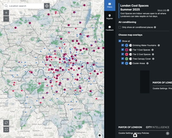
Managing extreme heat in cities by directing the public to places for heat stress relief and water sources.
Winter gardens: A brief history and warm variations

Extending the season with glass in different forms and terms.
Restoring Great Yarmouth's Winter Gardens

Transforming one of the least sustainable constructions imaginable.
Construction Skills Mission Board launch sector drive

Newly formed government and industry collaboration set strategy for recruiting an additional 100,000 construction workers a year.
New Architects Code comes into effect in September 2025

ARB Architects Code of Conduct and Practice available with ongoing consultation regarding guidance.
Welsh Skills Body (Medr) launches ambitious plan

The new skills body brings together funding and regulation of tertiary education and research for the devolved nation.
Paul Gandy FCIOB announced as next CIOB President

Former Tilbury Douglas CEO takes helm.
UK Infrastructure: A 10 Year Strategy. In brief with reactions

With the National Infrastructure and Service Transformation Authority (NISTA).